⚡ Key Facts
- Aging Infrastructure: According to the American Society of Civil Engineers (ASCE), the average age of the more than 91,000 dams in the United States is over 60 years old.
- High-Hazard Potential: FEMA reports there are over 16,000 "high-hazard potential" dams in the U.S., meaning their failure is anticipated to cause loss of human life.
- Unprecedented Speed: Water from a catastrophic dam failure can travel at speeds exceeding 30 miles per hour, arriving with little to no warning.
- Debris Multiplier: Unlike gradual floodwaters, a dam breach carries a massive "debris matrix" of trees, boulders, and structures, exponentially increasing its destructive force.
- Minimal Water Needed: The National Weather Service (NWS) warns that just 6 inches of fast-moving water can knock an adult off their feet, and only 2 feet can sweep away most vehicles.
Imagine living downstream from a serene, picturesque reservoir. For decades, it has provided recreation, drinking water, and a scenic backdrop to your community. But holding back millions of Water Calculator is an earth or concrete structure engineered in the mid-20th century. We pass by these massive structures daily, lulled into a false sense of security by their permanence. Yet, the illusion of invincibility surrounding our nation’s water infrastructure is cracking. With the increasing frequency of extreme weather events and decades of deferred maintenance, the threat of a catastrophic breach is no longer a localized hypothetical—it is a national reality. Understanding the sheer power of unleashed water and mastering dam failure preparedness is no longer optional for those living in the shadows of these silent giants. See disaster scenario library for a practical checklist.
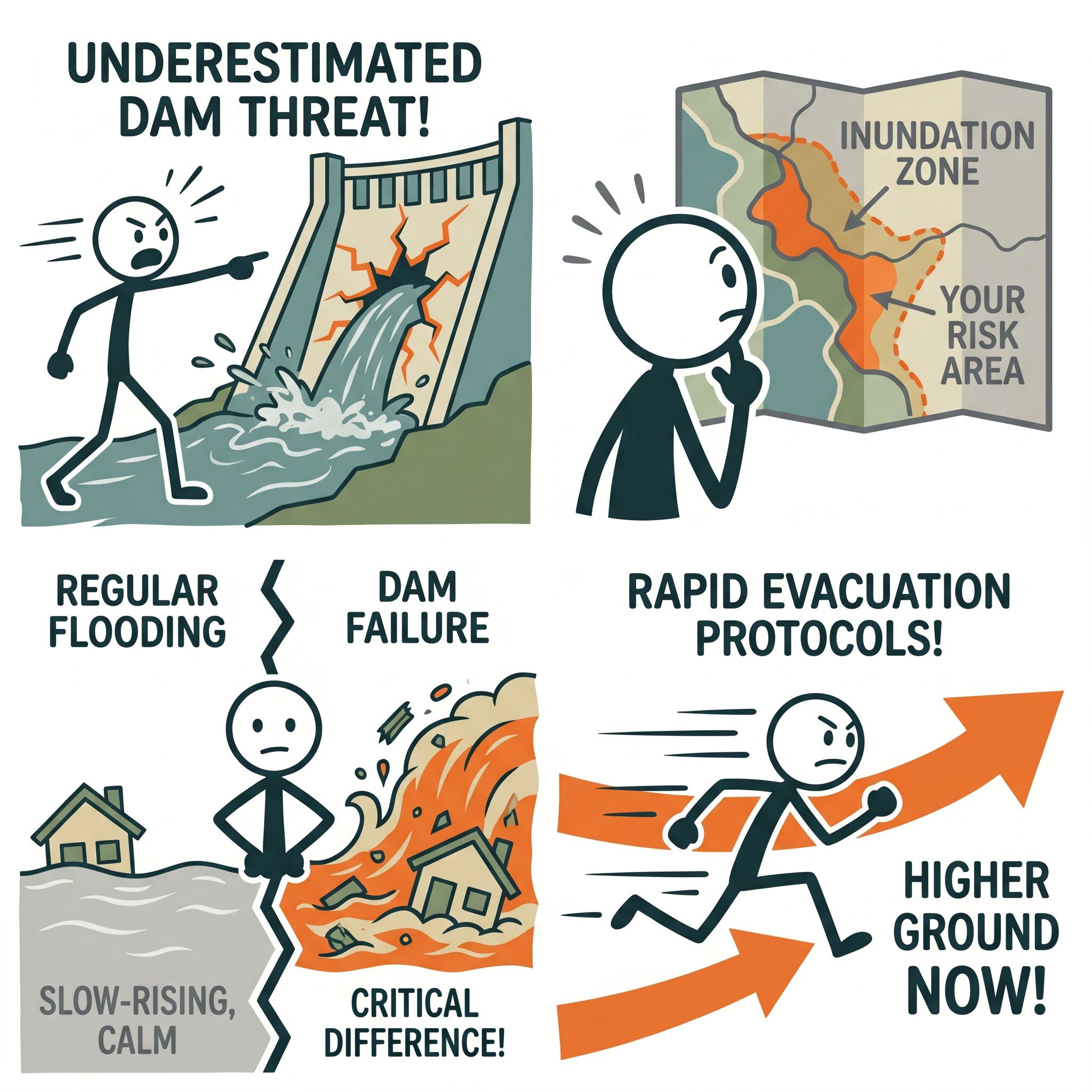
When a dam gives way, the rules of standard emergency response are rewritten in seconds. You are not dealing with a slowly rising river; you are facing an inland tsunami. The communities that survive these catastrophic events are not the ones who panic, but the ones who have pre-calculated their risks and mapped their escape routes. This comprehensive guide will demystify the mechanics of dam failures, teach you exactly how to locate your local inundation zones, and provide you with the rapid evacuation protocols necessary to outpace disaster. Empowerment comes from knowledge, and mastering these protocols ensures that if the wall ever breaks, you and your family will already be moving to higher ground. See family emergency plan guide for a practical checklist.
The Hidden Giant in Your Backyard: Understanding the Threat
To truly grasp the necessity of preparedness, we must first look at the data surrounding our water infrastructure. The American Society of Civil Engineers (ASCE) regularly issues a Report Card for America’s Infrastructure. In their most recent assessments, dams consistently receive a "D" grade. This alarming score is a reflection of aging materials, outdated engineering standards, and a severe lack of funding for critical repairs. See Protocol Survival app for a practical checklist.
The Federal Emergency Management Agency (FEMA) oversees the National Dam Safety Program. Through their data, we know that the United States is home to more than 91,000 dams. Of these, over 16,000 are classified as "high-hazard potential." This classification does not necessarily mean the dam is actively failing; rather, it indicates that if the dam were to fail, the resulting downstream inundation would likely result in the loss of human life. Furthermore, thousands of these high-hazard dams are considered "deficient" due to structural issues or their inability to handle modern, extreme rainfall events. See emergency preparedness guide for practical next steps.
The threat is compounded by climate change and shifting weather patterns. Dams built in the 1950s and 1960s were engineered based on the historical weather data of that era. Today, the National Oceanic and Atmospheric Administration (NOAA) frequently records "100-year" and "1,000-year" rain events happening with startling regularity. When a reservoir receives a year's worth of rain in a matter of days, the spillways and structural integrity of an aging dam are pushed far beyond their original design parameters. See natural disaster survival guide for practical next steps.
The Mechanics of a Breach
Dams do not fail for a single reason, and understanding how they break can help you recognize the warning signs. The most common cause of dam failure is overtopping. This occurs when water simply flows over the crest of the dam. For earth-fill dams—which make up the vast majority of U.S. dams—overtopping acts like a pressure washer, rapidly eroding the dirt and rock until the entire structure washes away in minutes.
Another insidious cause is piping and seepage. Water is relentless and will always seek the path of least resistance. If internal erosion occurs within the dam's foundation or embankment, water begins to tunnel through the structure. This "piping" can happen silently over years, culminating in a sudden, catastrophic collapse on a perfectly sunny day.
Finally, seismic activity poses a severe risk. Earthquakes can cause liquefaction in the soils supporting a dam or create deep fissures in concrete structures. For those living in seismically active regions, dam failure preparedness must be seamlessly integrated into your standard earthquake response plan.
The Critical Difference: Dam Failure vs. Regular Flooding
One of the most dangerous mistakes a homeowner can make is treating a potential dam breach like a standard flood. The psychological preparation and physical response required for these two events are entirely different. If you apply riverine flooding tactics to a dam failure, you will likely find yourself trapped.
Time and Predictability
Regular flooding, often referred to as riverine flooding, is typically a slow-moving disaster. The National Weather Service (NWS) and local hydrologists monitor river gauges and weather radar, often providing days of advance warning. You have time to sandbag your doors, move valuables to the second floor, and calmly evacuate your family and pets.
A dam failure, conversely, is an instantaneous shock event. Even if authorities are monitoring a stressed dam, the actual moment of structural collapse is entirely unpredictable. Once the breach occurs, millions of tons of water are released simultaneously. Depending on your proximity to the structure, your warning time may be reduced from days to mere minutes. There is no time for sandbagging; there is only time for immediate, rapid evacuation.
Velocity and The Debris Matrix
Standard floodwaters rise gradually, pooling in low-lying areas. While dangerous, the water is often relatively slow-moving. A dam breach creates a kinetic wall of water. This initial wave travels at terrifying speeds, often exceeding 30 miles per hour. The sheer hydraulic force of this wave is enough to shear homes off their foundations, snap mature trees like twigs, and toss commercial vehicles like toys.
Because of this destructive force, the water in a dam breach is rarely just water. It becomes a highly lethal "debris matrix." As the wave travels downstream, it picks up everything in its path: timber, vehicles, asphalt, toxic chemicals, and parts of destroyed buildings. You are not just trying to survive rising water; you are trying to survive a high-speed avalanche of heavy, grinding debris.
Levee Breaches: A Similar Threat
It is vital to include levee breach preparedness in this discussion. While dams hold back reservoirs, levees run parallel to rivers to protect adjacent low-lying floodplains. When a river swells and a levee fails—either by overtopping or structural collapse—the resulting inundation shares the same violent, rapid characteristics of a dam failure. The water forcefully violently into the dry floodplain, trapping residents who believed the levee would hold. Treating a levee breach with the same urgency as a dam failure is a critical survival mindset.
How to Find Your Dam Inundation Zone
You cannot plan an evacuation if you do not know the battlefield. The single most important step in inundation zone flood prep is identifying exactly where the water will go when the dam fails. This geographical footprint is known as the inundation zone.
Step 1: The National Inventory of Dams (NID)
Your first resource is the U.S. Army Corps of Engineers (USACE), which maintains the National Inventory of Dams (NID). By visiting the NID website, you can use their interactive map to locate dams in your immediate vicinity. The database will provide crucial information, including the dam's hazard potential classification, its primary purpose, and its height.
Do not just look for dams immediately upstream. Look at the entire watershed. A massive dam failure 20 miles away can still push a devastating wall of water into your community, depending on the topography of the river valley.
Step 2: Securing Inundation Maps
While the NID tells you where the dams are, you need specific inundation maps to see the projected path of the water. For security reasons, highly detailed inundation maps for critical infrastructure are not always published on public websites. However, they are available to the public through the proper channels.
Contact your local county Emergency Management Agency (EMA) or Office of Emergency Services (OES). Ask them directly: "I am developing my family's emergency response plan. Am I located in a dam inundation zone, and can I view the inundation map for our area?"
Step 3: Analyzing the Data
When you view an inundation map, you must look for three critical pieces of data:
- Arrival Time: How long will it take for the leading edge of the water to reach your home or workplace after a breach? If the arrival time is 15 minutes, your family emergency plan must be hyper-aggressive.
- Peak Depth: How high will the water get? If the peak depth at your location is 20 feet, vertical evacuation to a second-story roof is not a viable survival strategy; you must leave the zone entirely.
- Duration of Inundation: How long will the water remain before receding? This dictates how long you will be displaced and what supplies you need to survive.
Building Your Dam Safety Emergency Plan
Once you understand your geographic risk, you must codify your response. A robust dam safety emergency plan removes the need for decision-making during a crisis. When the siren sounds or the alert hits your phone, your brain will be flooded with adrenaline. A well-rehearsed plan ensures you act on muscle memory rather than panic.
Redundancy in Alerts and Warnings
You cannot evacuate if you do not know the dam has failed. Relying on a single source of information is a fatal flaw in any emergency plan. You must build a redundant alert system.
First, ensure your smartphone is set to receive Wireless Emergency Alerts (WEA). These are the geographically targeted, text-like messages sent by authorized government alerting authorities. Second, invest in a dedicated NOAA Weather Radio with a battery backup and Specific Area Message Encoding (SAME) technology. This radio will wake you up in the middle of the night if a flash flood emergency or dam failure warning is issued for your specific county.
Never rely solely on outdoor warning sirens. Sirens are designed to be heard by people who are outdoors; they are frequently drowned out by heavy rain, thunder, wind, and modern home insulation.
The Communication Framework
During a localized disaster, cellular towers are quickly overwhelmed by call volume or destroyed by the floodwaters. Your dam safety emergency plan must include an out-of-state emergency contact. If your family is separated when the breach occurs, everyone should be instructed to text (not call) this out-of-state contact to check in. Text messages require significantly less bandwidth than voice calls and are more likely to push through a congested network.
Pre-Staging Your Go-Bag
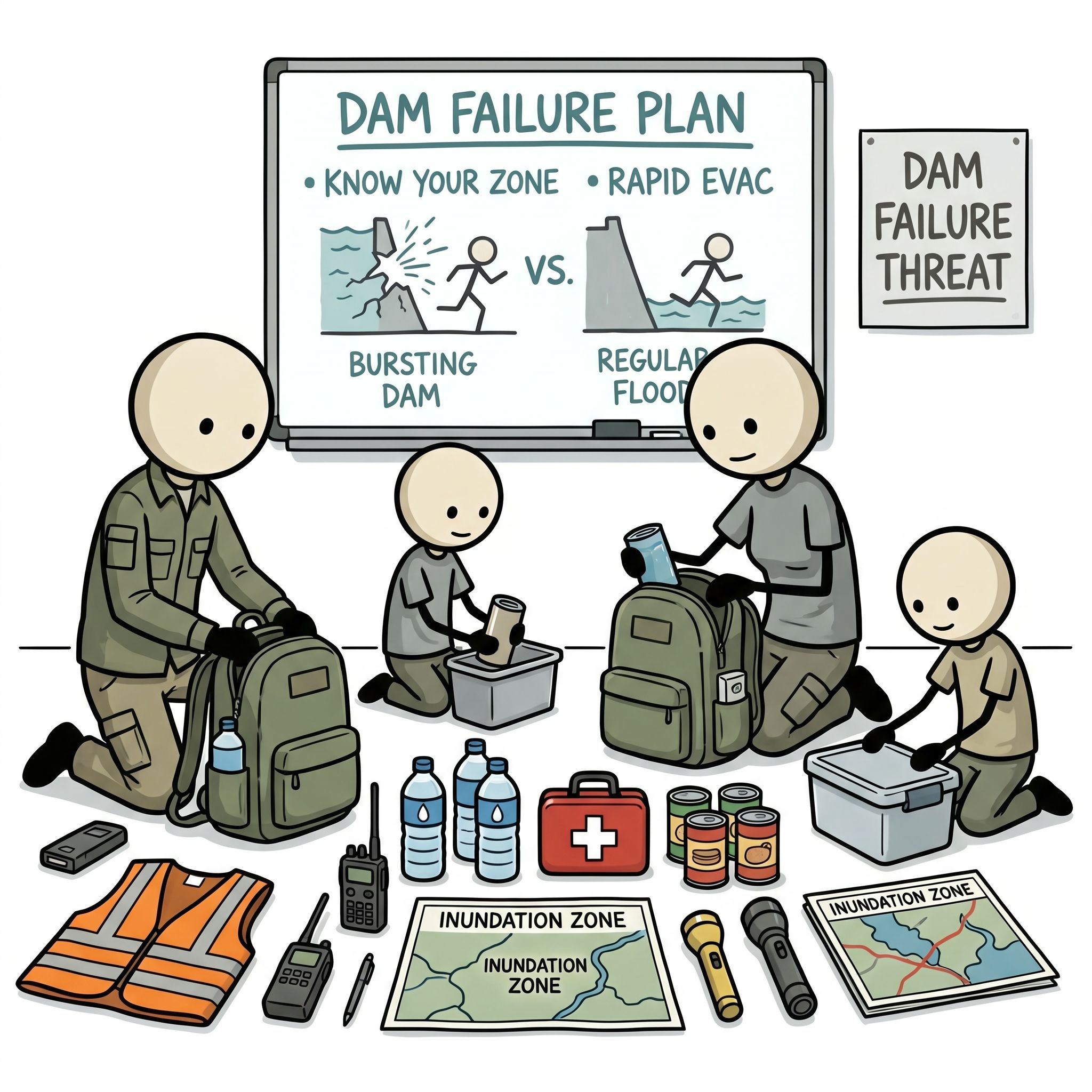
A standard earthquake or hurricane kit is great, but a dam breach evacuation requires a specialized approach. Because you may be fleeing rising water, your go-bag essentials guide must be lightweight, waterproof, and easily carried on foot.
Pack your essential documents (insurance policies, IDs, deeds) in watertight localized dry bags. Include high-calorie emergency rations, water purification tablets (as local municipal water will immediately become contaminated), a first aid kit, headlamps with extra batteries, and a localized topographic map. Do not rely on GPS mapping on your phone; cell service will likely fail, and digital maps do not always clearly show elevation contours.
Rapid Evacuation Protocols: When Seconds Count
The core of your survival strategy hinges on the dam break evacuation protocol. When a "Flash Flood Emergency" is issued due to an imminent or ongoing dam failure, the window for action is incredibly narrow. This is not the time to gather photo albums or wait to see if the water reaches your street. This is "Go Time."
The 10-Minute Rule
If you live within the immediate downstream inundation zone (where water arrival times are under 30 minutes), you must adopt the 10-Minute Rule. From the moment the alert is received, you and your family must be out of the door and moving toward higher ground in 10 minutes or less. This requires keeping your Go-Bags near the exit, keeping your vehicle's gas tank at least half full at all times, and conducting regular family evacuation drills.
Lateral vs. Vertical Evacuation
Your evacuation route must be pre-planned and physically driven before a disaster strikes. The goal of a dam break evacuation is not necessarily to drive far away; it is to drive up.
Lateral Evacuation: This is the ideal scenario where you have enough time to drive completely out of the inundation zone laterally. However, you must ensure your lateral route does not cross bridges or low-water crossings that will be destroyed by the initial wave. Your map should highlight routes that immediately ascend out of the river valley.
Vertical Evacuation: If the breach has already occurred, or if traffic gridlock prevents you from driving out of the valley, you must execute a vertical evacuation. This means abandoning your vehicle and moving up the nearest steep terrain on foot. A vehicle caught in a dam breach is a death trap. The CDC and NWS repeatedly warn that it takes only 18 to 24 inches of moving water to sweep away a truck or SUV. If water begins rising over the road while you are driving, abandon the car immediately and scramble up the nearest hill, embankment, or solid concrete parking structure.
Navigating the Gridlock
Human nature dictates that during a sudden panic, everyone will attempt to use the main arterial highways to escape. This inevitably leads to gridlock. Your dam safety emergency plan must include secondary and tertiary evacuation routes using backroads.
If you are trapped in gridlock and the water is approaching, you must make the difficult psychological decision to leave your property behind. Your vehicle can be replaced; your life cannot. Grab your Go-Bag, exit the vehicle, and move to high ground on foot.
What If You Are Trapped?
If you receive no warning and the water is already surrounding your home, do not attempt to swim in a dam breach. The debris matrix and violent currents make survival in the water highly unlikely.
Move to the highest possible point in your home. If you must retreat to an attic, you must have a tool (like an axe or heavy crowbar) pre-staged there to chop through the roof. Countless individuals have drowned in flood events because they retreated into their attics to escape rising water, only to find themselves trapped with no way to break through to the roof.
Post-Failure Realities: Navigating the Aftermath
Surviving the initial wave of a dam failure is only the first phase of the emergency. The post-failure environment is highly hazardous and requires strict adherence to safety protocols to prevent injury or illness.
Toxic Waters and Hidden Dangers
Once the violent wave passes, the remaining floodwater is profoundly contaminated. The Centers for Disease Control and Prevention (CDC) warns that floodwaters following major infrastructural failures contain raw sewage, agricultural runoff, industrial chemicals, and heavy metals.
Do not wade through standing water unless absolutely necessary for survival. Even a small cut exposed to this water can lead to severe bacterial infections, including tetanus and vibrio. If you must move through the water, use a sturdy walking stick to probe the ground in front of you. The violent currents of the dam breach will have washed away manhole covers, created massive sinkholes, and left jagged debris hidden just beneath the murky surface.
Infrastructure Wipeout
Understand that a dam failure does not just destroy homes; it wipes out the foundational infrastructure of a community. Roads will be washed away, bridges will be structurally compromised, and the power grid will be down for weeks, if not months. Water treatment plants located in the river valley will be destroyed, meaning there will be no safe tap water.
This is why your inundation zone flood prep must include a plan for prolonged displacement. You cannot expect to return to your home a few days after the event. Your emergency plan should factor in temporary housing solutions, access to financial reserves, and a strategy for communicating with your insurance providers from a remote location.
The Psychological Toll
Finally, acknowledge the psychological impact of a sudden-onset disaster. The loss of a home, community, and a sense of safety in a matter of minutes is deeply traumatizing. Empowering yourself through preparation is the best way to mitigate this trauma. Knowing that you took the necessary steps to protect your family provides a foundation of mental resilience that will be crucial during the long recovery process.
Taking Control of Your Safety
The sheer scale of a dam failure can feel overwhelming, but it is a highly survivable event if you respect the physics of water and prepare accordingly. The aging state of our national infrastructure means we can no longer rely solely on concrete and earth to keep us safe; we must rely on our own vigilance. By taking the time today to locate your inundation zone, build a redundant alert system, and rehearse your rapid evacuation routes, you transform yourself from a potential victim into a prepared survivor. You cannot control the structural integrity of the dam upstream, but you have absolute control over how fast and how smart you react if it ever gives way. Stay informed, map your routes, and always know your way to higher ground.
Frequently Asked Questions
How do I find out if I'm in a dam inundation zone?
Contact your state dam safety office or county emergency management to request local Emergency Action Plan (EAP) inundation maps. Many states publish these publicly. If you're downstream of any dam, assume you're at some level of risk.
How fast does water move in a dam failure?
In major dam failures, flood waves can travel at 25-75 mph and carry walls of water 50-100 feet high. The 1976 Teton Dam failure sent a 30-foot wall of water traveling at 15 mph — fast enough to overtake runners.
How is dam failure flooding different from regular flooding?
Regular flooding builds gradually. Dam failure produces a sudden, catastrophic surge carrying trees, vehicles, and structural debris at extreme velocity. The water is also heavily laden with sediment and pollutants — destructive force is orders of magnitude greater.
Sources & Further Reading
- FEMA Dam Safety Program
- ASDSO Association of State Dam Safety Officials
- NWS Flash Flood Safety
Related resource: Emergency Preparedness Guide.